Kane County woman says Allstate threatened to drop insurance over Google Earth photos
A woman in Kane County, Illinois, said Allstate threatened to drop her insurance coverage after reviewing pictures of her property that were taken without her knowledge.
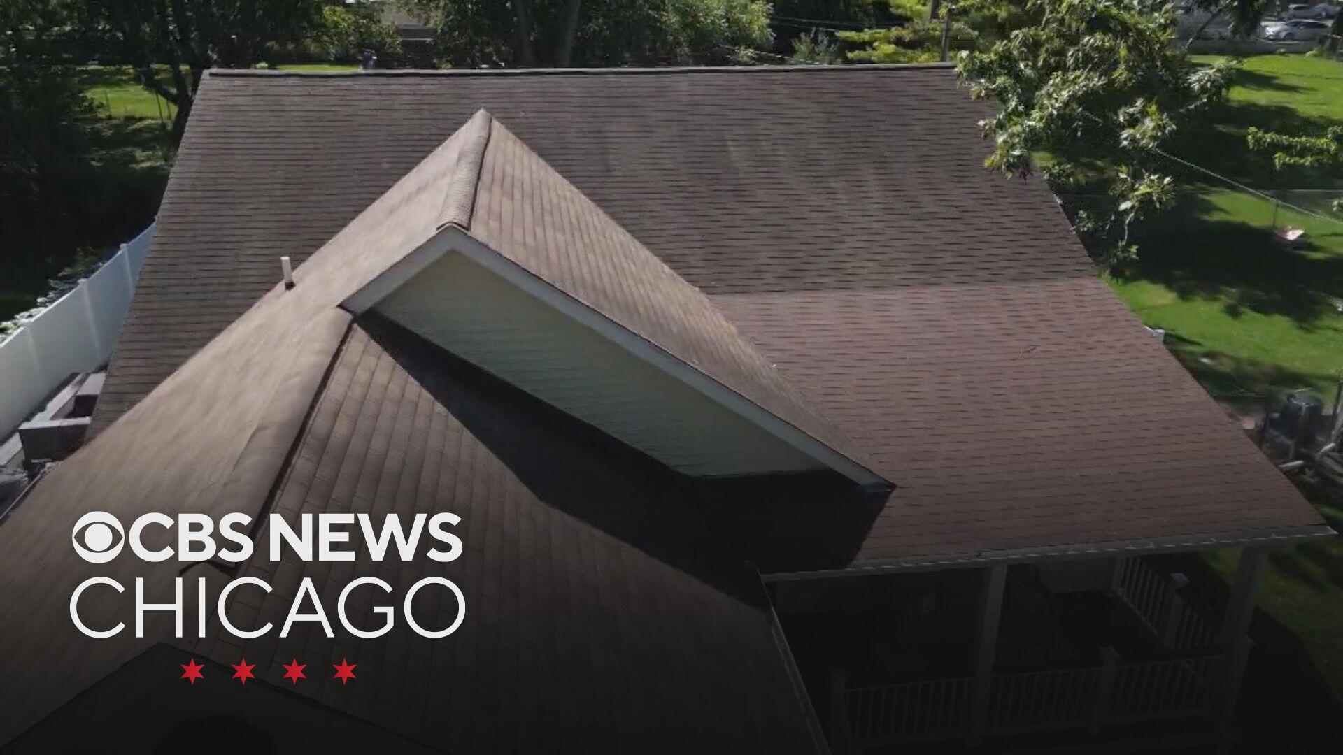
Roseanna Castillo said her insurer used Google Earth to snap aerial photos of her property. Then she received a letter that claimed her roof showed "granular loss."
"In order for me to keep my policy, they want me to pay $18,000 and they gave me like a month and a half's notice to do this," she said.
Castillo was told to replace her roof entirely, or get her own photos to prove it's in good shape, otherwise she'd risk losing her coverage in November.
"I thought that this was absurd," Castillo said. "This is an unsolicited inspection on my home. I never asked for this."
Consumer advocates like Amy Bach said insurers are increasingly turning to drones and aerial surveillance for underwriting.
"It's unregulated," Bach said. "They can take pictures whenever they want, they don't have to give notice to the homeowner."
The images are often reviewed by artificial intelligence, but the technology can get it wrong.
Castillo filed a complaint with the state. Days later, her insurance company dropped the roof requirement without needing any proof.
"I did email the agent and let them know I was going to be speaking with CBS, and I had filed a Department of Insurance claim," Castillo said. "There was no longer a stipulation for me to keep my insurance and my policy would renew like normal in November."
If this happens to you, you can ask your insurer for photos. If they refuse, file a complaint with the Illinois Insurance Department.
An Allstate spokesperson responded with the following statement:
"Allstate continues to support this customer with homeowners insurance coverage. To clarify, drones and AI were not used in this process. We use aerial imagery to enhance the customer experience, ensure pricing accuracy and fairness, and support safer, faster, and less intrusive property inspections compared to in-house visits."
In its own statement, the Insurance Information Institute, an insurance industry association, defended the use of drones for home inspections:
"Insurers are using drones to make the home inspection and underwriting process more efficient and cost-effective. Additionally, conducting aerial inspections is much less intrusive and safer than sending an inspector to each home and having them climb on your roof. Aerial inspections capture the type of data insurers need to make prudent underwriting decisions and determinations if the property fits their risk profile. It also helps identify areas where the homeowner can make improvements to ensure they maintain coverage, such as a poor roof condition."


