Rain, cooler weather expected in Maryland mid-week

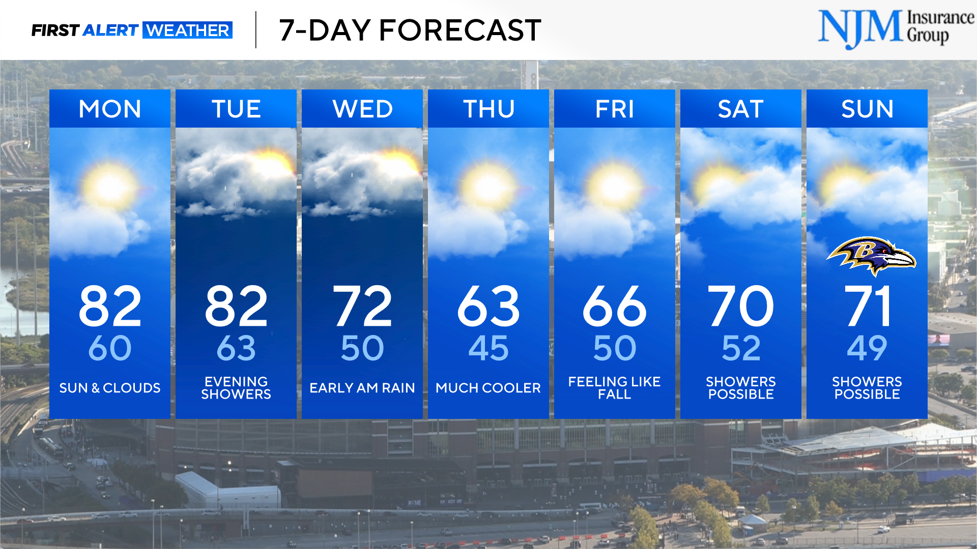
Warm afternoons are in the forecast as the new workweek begins. The warming trend ends as a strong cold front brings rain and much cooler weather back to central Maryland heading into mid-week.
Beautiful weather Sunday evening
Temperatures will cool back into the low and mid- 60s in Baltimore before midnight. It'll remain a bit milder than the past few evenings across our region. The forecast remains dry, with just a few clouds and patchy fog tonight into Monday morning.
Warmer weather expected in Maryland
The gradual warming trend that began Friday afternoon continues into the start of the new workweek.
Morning temperatures will be in the 50s and lower 60s Monday and Tuesday mornings. Both humidity and afternoon temperatures will noticeably increase as the workweek begins. Temperatures peak in the low to mid-80s both Monday and Tuesday afternoons across our region. It'll be the warmest northwest of Baltimore.
Clouds increase Tuesday. A chance of scattered rain arrives Tuesday evening.
Wet weather, cool-down in Maryland mid-week
The chance of rain peaks Tuesday night, into the first half of Wednesday across the Baltimore metro, central Maryland and the eastern shore as a cold front approaches.
Wednesday morning's commute could be damp and slower than normal. The WJZ First Alert Weather Team is keeping an eye on Wednesday morning's forecast. If rain trends heavier or the chance of storms increases, we'll give you a heads up. Much cooler weather blows in as soon as the rain stops Wednesday. Afternoon temperatures remain in the 60s and 70s.
Chilly mornings and cool, mostly sunny afternoons begin Thursday and linger into the start of next weekend.
Have a great Saturday evening,
Cutter


